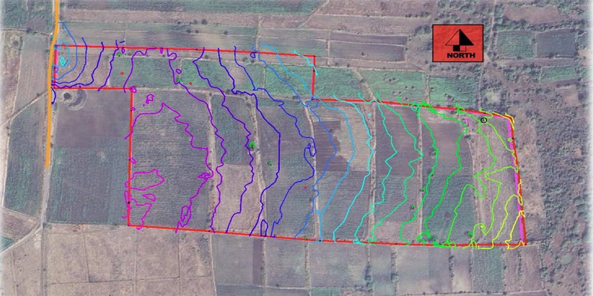

Every successful infrastructure project begins with understanding the site's natural water behavior. Whether you're planning a residential township, industrial facility, highway, railway, airport, or commercial development, a Hydrology Study plays a critical role in ensuring long-term safety, regulatory compliance, and cost-effective design.
A hydrology study analyzes how rainfall, runoff, streams, rivers, and drainage systems interact with a project site. The findings help engineers design efficient stormwater systems, prevent flooding, and protect infrastructure from water-related damage.
Ignoring hydrological conditions can lead to drainage failures, flooding, erosion, project delays, and expensive maintenance costs. That's why hydrological analysis has become a mandatory component for many infrastructure developments.
For more details: https://www.sunconengineers.com/hydrology-study/
What is a Hydrology Study?
A hydrology study is a scientific assessment of how water moves across and through a project area. It evaluates rainfall patterns, watershed characteristics, surface runoff, drainage paths, flood potential, and water flow behavior.
Using field survey data, GIS mapping, Digital Elevation Models (DEM), satellite imagery, and hydraulic modeling software, engineers estimate the amount of water expected during various rainfall events and design infrastructure accordingly.
The objective is to ensure that excess stormwater is safely collected, conveyed, stored, or discharged without causing flooding or environmental damage.
Why is Hydrology Study Important?
Proper hydrological assessment provides the technical basis for designing reliable infrastructure. It helps project owners avoid costly mistakes during construction and operation.
Some of the major benefits include:
- Reduces flood risks
- Improves stormwater drainage design
- Prevents waterlogging
- Protects roads and structures
- Supports environmental approvals
- Optimizes drainage infrastructure costs
- Improves long-term sustainability
- Ensures regulatory compliance
Applications of Hydrology Studies
Hydrology studies are required across various infrastructure sectors.
· Residential Townships: Proper stormwater planning prevents water accumulation, basement flooding, and drainage failures.
· Industrial Projects: Manufacturing facilities require efficient drainage systems to protect production areas and equipment.
· Roads and Highways: Hydrological analysis helps determine culvert sizes, roadside drains, cross-drainage structures, and bridge openings.
· Railways and Metro Projects: Safe water management reduces track flooding and protects transportation infrastructure.
· Airports: Runways and taxiways require precise drainage design to ensure operational safety.
· Smart Cities: Urban developments need integrated stormwater management to handle increasing rainfall due to urbanization.
· Industrial Parks & SEZs: Large developments require watershed analysis and runoff management for sustainable infrastructure planning.
Key Components of a Hydrology Study
A professional hydrology study generally includes the following analyses.
· Rainfall Analysis: Historical rainfall records are collected to estimate rainfall intensity, duration, and frequency.
· Watershed Delineation: The contributing catchment area is identified using GIS and terrain models.
· Runoff Estimation: Engineers calculate runoff generated during different rainfall events using accepted hydrological methods.
· Drainage Network Assessment: Existing natural drains, streams, canals, and drainage paths are evaluated.
· Flood Risk Assessment: Potential flood levels and flood-prone areas are identified.
· Hydraulic Analysis: Water flow through drains, culverts, channels, and rivers is analyzed to verify adequate capacity.
· Stormwater Drainage Design: Based on hydrological calculations, suitable drainage systems are designed.
Data Required for Hydrological Analysis
Accurate results depend on reliable input data, including:
- Topographic Survey
- Drone Survey (where applicable)
- Digital Elevation Model (DEM)
- Rainfall Data
- Watershed Maps
- Soil Characteristics
- Land Use & Land Cover Data
- Existing Drainage Network
- River Cross Sections
- Project Layout
Software Used for Hydrology Studies
Modern hydrology consultants use advanced engineering software to improve analysis accuracy.
Commonly used software includes:
- HEC-HMS
- HEC-RAS
- ArcGIS
- QGIS
- AutoCAD Civil 3D
- SWMM (Storm Water Management Model)
- MIKE FLOOD (for complex studies)
These tools help simulate rainfall-runoff relationships, flood behavior, and stormwater flow under different conditions.
Hydrology Study Process
A systematic approach ensures accurate and dependable results.
1. Site Investigation: Engineers collect field data and review project information.
2. Survey & Data Collection: Topographic surveys, GIS datasets, rainfall records, and watershed information are gathered.
3. Catchment Analysis: Drainage patterns and contributing watershed areas are identified.
4. Hydrological Modeling: Rainfall-runoff models are developed to estimate peak discharge.
5. Hydraulic Assessment: Existing and proposed drainage systems are evaluated.
6. Design Recommendations: Suitable stormwater management solutions are prepared.
7. Final Hydrology Report: A comprehensive technical report is submitted with calculations, drawings, and recommendations.
Industries That Require Hydrology Studies
Hydrology studies are commonly required for:
- Residential Developers
- Industrial Developers
- Government Infrastructure Projects
- Highways
- Railways
- Airports
- Smart Cities
- Industrial Parks
- Logistics Parks
- Commercial Developments
- Mining Projects
- Renewable Energy Projects
Why Choose Professional Hydrology Consultants?
Hydrology is not just about calculations it directly impacts project safety, approvals, and long-term performance. An experienced consultant combines field surveys, GIS analysis, hydraulic modeling, and engineering expertise to deliver practical, cost-effective solutions tailored to site conditions.
Professional consultants also ensure compliance with local regulations, optimize drainage infrastructure, and reduce the risk of flooding or construction delays.
View Full Article: https://www.sunconengineers.com/hydrology-study/
Partner with Experienced Hydrology Study Consultants
Whether you're developing a township, industrial plant, highway, commercial complex, or public infrastructure, investing in a detailed hydrology study is one of the smartest decisions you can make. Early hydrological assessment minimizes design risks, improves drainage performance, and helps avoid costly modifications during construction.
At Suncon Engineers, we provide end-to-end Hydrology Study, Watershed Analysis, Stormwater Drainage Design, Flood Risk Assessment, and Hydraulic Modeling services using advanced engineering tools and experienced professionals. Our solutions help clients design resilient, compliant, and sustainable infrastructure projects.
Planning a new project? Contact our hydrology experts today for a customized hydrology study and ensure your development is built on a strong, data-driven foundation.
Frequently Asked Questions (FAQs)
What is a hydrology study?
A hydrology study evaluates rainfall, runoff, drainage, and water flow to support safe infrastructure design.
Why is a hydrology study important?
It helps prevent flooding, improves drainage design, and supports regulatory approvals.
Which projects require a hydrology study?
Residential, industrial, commercial, highways, railways, airports, and infrastructure projects commonly require hydrological analysis.
What software is used for hydrology studies?
HEC-HMS, HEC-RAS, ArcGIS, QGIS, Civil 3D, SWMM, and MIKE FLOOD are widely used.
What data is needed for a hydrology study?
Topographic survey, rainfall records, DEM, watershed data, soil information, land use, and drainage details.
How long does a hydrology study take?
The timeline depends on project size and available data, but most studies are completed within a few weeks.
Can a hydrology study reduce project costs?
Yes. It helps optimize drainage infrastructure, reducing construction, maintenance, and flood-related expenses.
Do hydrology studies help obtain project approvals?
Yes. Many government authorities and infrastructure agencies require hydrological assessments as part of the approval process.
View More Blogs:
Hydrological Study and Analysis Company in India: https://www.sunconengineers.com/hydrology-study-and-analysis-company-in-india/
Hydrology Study in India: Infrastructure Planning and Flood Management: